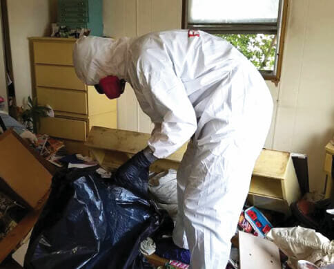
Bio-One of Columbus services all types of trauma, distressed property, and biohazard scenes in communities throughout Morrow County Area. We partner with local authorities, communities, emergency services personnel, victim services groups, hoarding task forces, apartment complexes, insurance companies and others to provide the most efficient and superior service possible.
We are your Morrow County crime scene cleaners dedicated to assisting law enforcement, public service agencies and property owners/managers in restoring property that has been contaminated as a result of crime, disaster or misuse.
Morrow County is a county located in the U.S. state of Ohio. As of the 2010 census, the population was 34,827. Its county seat is Mount Gilead. The county was organized in 1848 from parts of four neighboring counties and named for Jeremiah Morrow, Governor of Ohio from 1822 to 1826. Shawnee people used the area for hunting purposes before white settlers arrived in the early 19th century. Morrow County is included in the Columbus, OH Metropolitan Statistical Area. In 2010, the center of population of Ohio was located in Morrow County, near the village of Marengo. Morrow County's historic World War I Victory Shaft, unique in the United States, is located in the center of downtown Mount Gilead. Other areas interesting to the tourist include: Mount Gilead State Park; Amish farms and businesses near Johnsville and Chesterville; the Mid-Ohio Sports Car Course near Steam Corners; the rolling Allegheny foothills of eastern Morrow County; the site of the birthplace of President Warren G. Harding near Blooming Grove; the site of the former Ohio Central College in Iberia; the early 19th-century architecture of buildings in Chesterville, Ohio; the Revolutionary War Soldiers' Memorial in Mount Gilead; the Civil War monument in Cardington; and the mid-19th-century architecture of the Morrow County Courthouse and Old Jail in Mount Gilead.
Geography
According to the U.S. Census Bureau, the county has a total area of 407 square miles (1,050 km²), of which 406 square miles (1,050 km²) is land and 1.1 square miles (2.8 km²) (0.3%) is water. Morrow County is considered to be a part of "Mid Ohio."
Demographics
As of the 2010 United States Census, there were 34,827 people, 12,855 households, and 9,578 families residing in the county. The population density was 85.8 inhabitants per square mile (33.1/km²). There were 14,155 housing units at an average density of 34.9 per square mile (13.5/km²). The racial makeup of the county was 97.7% white, 0.3% black or African American, 0.3% Asian, 0.1% American Indian, 0.2% from other races, and 1.3% from two or more races. Those of Hispanic or Latino origin made up 1.1% of the population. In terms of ancestry, 30.8% were German, 16.1% were American, 14.4% were Irish, and 13.3% were English.